📅 Visited: June 2024
The moment we came up onto the ridge, the wind hit us head-on.
It was strong.
Strong isn’t quite the word, actually. I couldn’t breathe properly.
Every time I tried to inhale through my nose, the wind shoved the air back out.
It was June, and it was almost chilly.
I lifted my head into that wind, and there was a narrow ridge running out toward the sea, on and on.
Blue sky. Green grass underfoot. And beyond that, blue sea again.
Except the sea wasn’t one blue.
It was two.
We looked at the forecast for day two, and flipped the whole trip
Let me start with the single best decision we made on this trip.
Shakotan was originally scheduled for our second day.
But the forecast for day two looked bad.
So the night before, we swapped the two days wholesale.
To cut to the ending: this was exactly the right call.
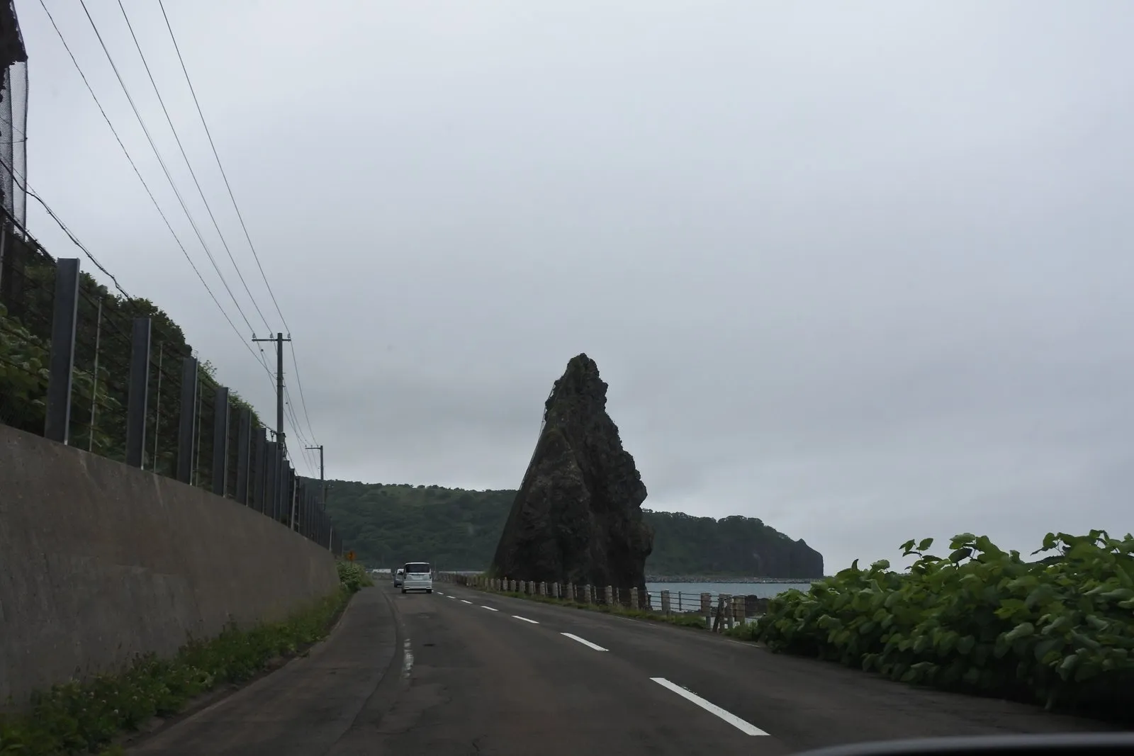
We drove the coastal highway in a rental car.
At this point the sky was still overcast and the road was still wet.
And up ahead, a black triangle of rock was thrusting up out of the sea.
Nothing had started yet, and the scenery had already started.
That’s the kind of road it was.

She was right.
A friend had recommended Shakotan to us roughly a decade ago, and it had sat in the back of our minds ever since.
Now we were finally standing at the entrance.
Cape Kamui — the view changes with every step
We parked and started walking.
Cape Kamui (Kamui Misaki) is a long, thin ridge, and the trail runs along the top of it all the way out to the tip.
The path was well maintained.
Long stretches of boardwalk meant I could walk without watching my feet.
And somewhere along the way, I noticed something.
The view kept changing. Constantly.
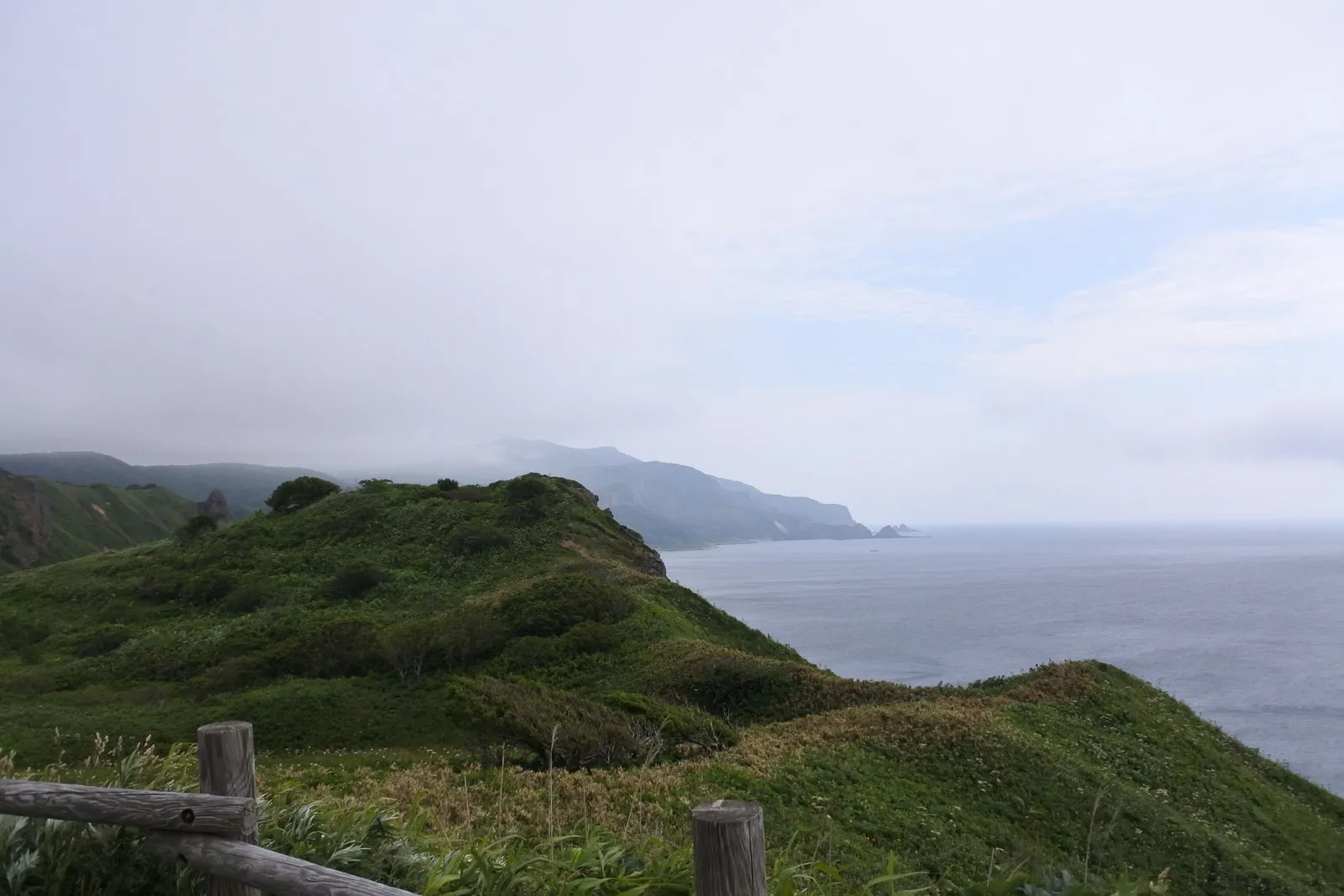
Walk a little, and a stretch of coastline that had been hidden comes into view.
Walk a little more, and the far side of the ridge opens up.
Turn around, and the scene behind you has rearranged itself into something else.
The walk was just as good on the way back.
We were retracing exactly the same path, and it never once got dull.
The rock underfoot changed character too, from one spot to the next.
Sandy and loose in places.
Bare, lumpy boulders in others.
And in some places, bands of colored rock.
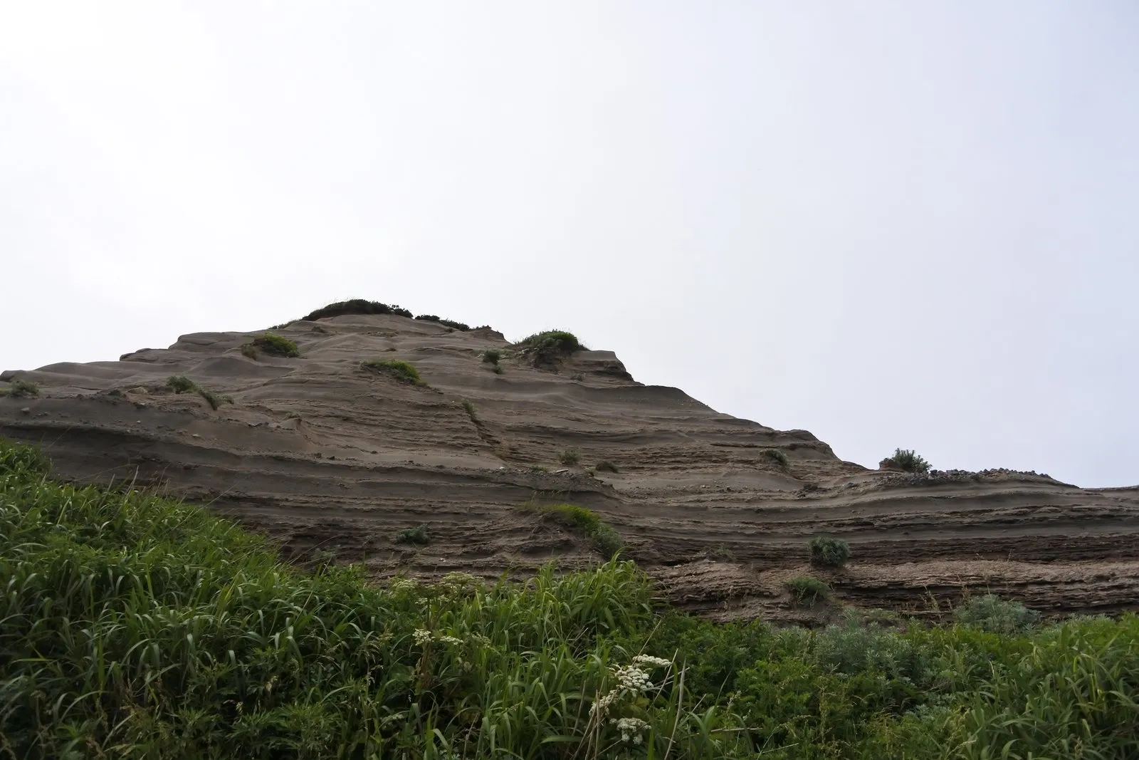
Beyond the grass, a hump of rock stood with horizontal stripes cut cleanly across it.
The layers just ran sideways, as plain as ruled lines.
The ground was changing underneath us at walking pace.
The season helped, I think.
White flowers, yellow flowers, purple flowers lined the trail.
The yellow ones looked like some kind of lily.
I don’t know what they were.
We didn’t find out. We just kept saying “those are pretty” and kept walking.
And then, the sea.
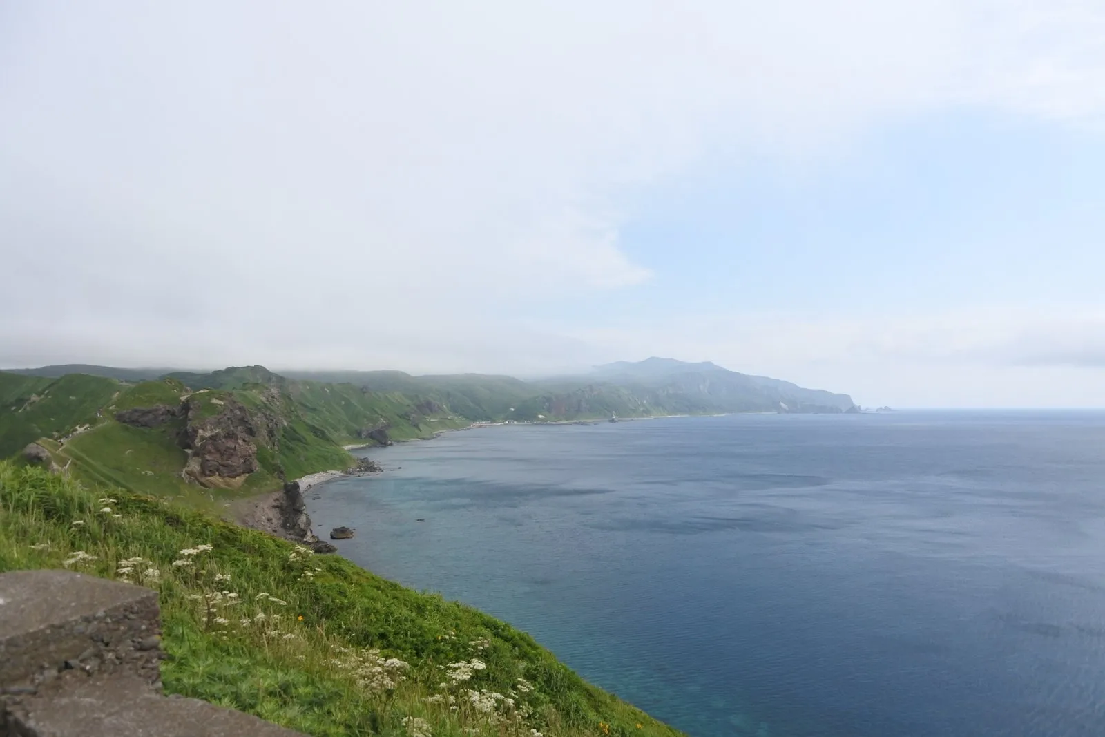
Looking down from high on the ridge, the cove below was split into two blues.
The shallows nearest the shore were a bright turquoise.
A short distance out, it snapped to deep navy.
It wasn’t a gradient. It looked as though someone had drawn a line.
And the water was astonishingly clear.
We walked along asking each other why it looked like that.
The peninsula has few large rivers, so relatively little sediment washes into the sea, and the water is thought to stay transparent as a result.
On top of that, the color is said to change with depth. In the shallows, light bounces off the seabed and comes back up to you, so the water reads as a bright turquoise. In deeper water, the light is absorbed before it can return, and only the blue wavelengths make it back to your eye — hence the deep navy.
So the reason a single cove looked split cleanly into two colors is, most likely, that the seabed drops off suddenly right along that line.
Walking there, I kept thinking of Shiretoko.
There’s something in common with the trails we walked in Shiretoko a while back.
The sense of scale. The way the view keeps turning over into a new one.
On a par with Shiretoko, or just a notch below.
That’s where I’d put it.

In fairness, I should note the downside too.
It gets crowded, and the trail is narrow.
Again and again, one party had to stop and wait for the other to pass.
Purely for comfort, Shiretoko wins.
Even so, it was a place I was glad we’d come to.
| Location | Shakotan-cho, Shakotan District, Hokkaido |
| Parking | Yes (free) |
| Highlight | The ridge-top trail — a view that changes with every step, and a sea split into two blues |
| Watch out for | Extremely strong wind. It's chilly even in June, so bring a jacket. The trail is well maintained but narrow |
There was a wide pull-off, so we stopped
This happened on the drive from Cape Kamui to Cape Shakotan.
Beside the road was an oddly large open space.
Shakotan Coast Parking, the sign said.
With no particular purpose in mind, we pulled in.
It turned out to be an unexpectedly good stop.
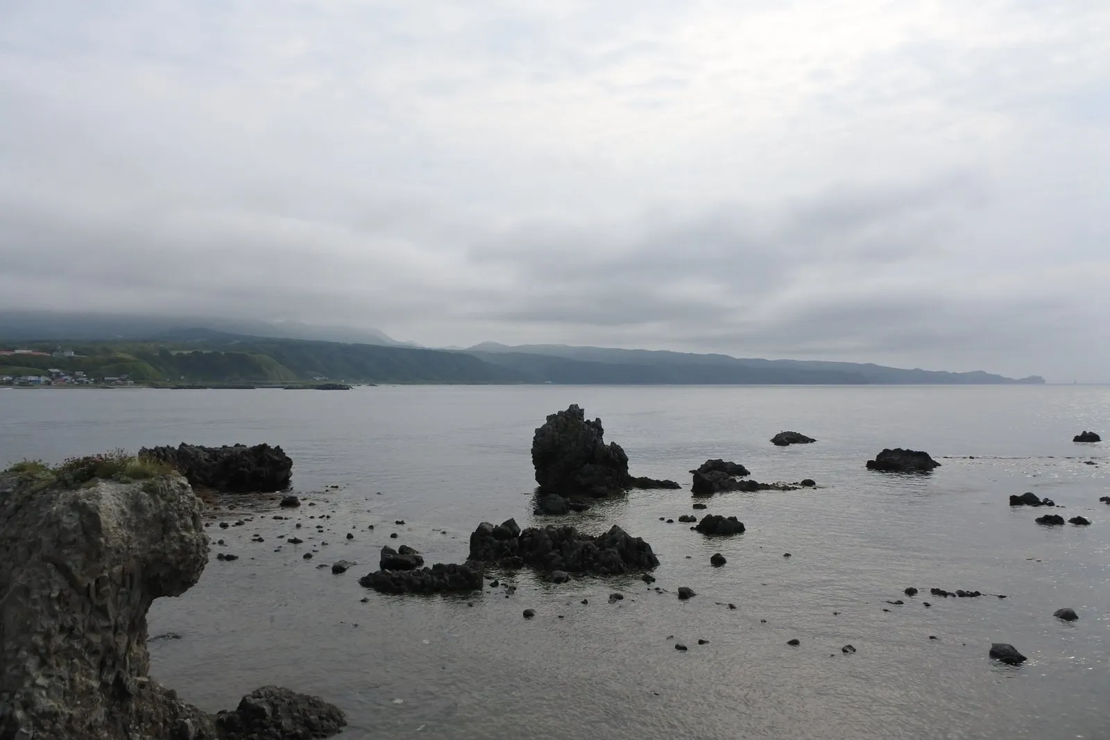
Black rocks poked up out of the water, scattered across the shallows.
In the distance, we could see the opposite shore and a village.
And when we turned around — there was Cape Kamui, the ridge we’d just been walking.
Looking from the outside at the place where you were standing a moment ago.
That turned out to be surprisingly satisfying.
The water at our feet was completely transparent.
Down on the bottom, seaweed swayed back and forth.
I could have watched it for ages.
Farther out, an older man was fishing from the top of one of the rocks.
How on earth had he got out there?
Did he walk across at low tide?
The two of us debated this for a good while.
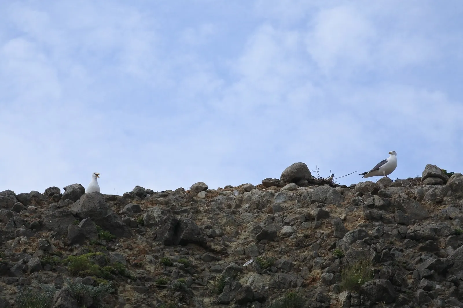
On one of the big rocks, there were birds.
At the time I registered them as “some white birds” and left it at that.
It was only after we got home, looking back through the telephoto shots, that I noticed.
There was a chick.
Right beside the adult, a second, smaller bird.
Something I’d missed on the spot had been sitting there in the photo all along.
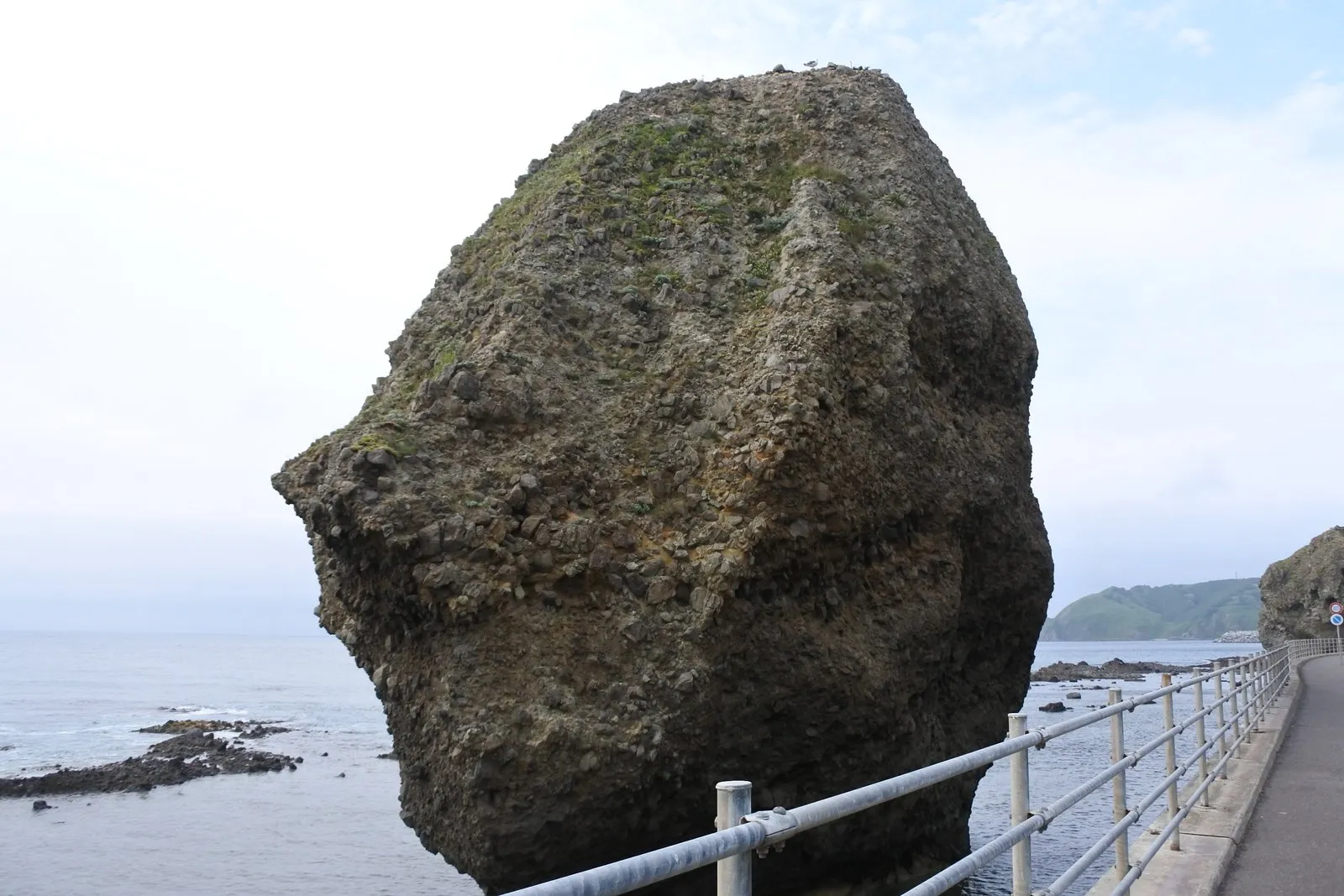
Along this stretch there were boulders of every shape.
Up close, some of them were packed solid with small stones, like concrete.
No two were alike, so we never got bored of looking.
Hard rock originating from undersea volcanic activity and the more fragile material around it are worn down by the waves at different rates.
The fragile parts go first. The hard parts get left behind. The result is rock standing on its own out in the water.
Those black rocks dotting the shallows, in other words, are the survivors.
This place wasn’t on our itinerary at all.
I’m glad we stopped on a whim.
Cape Shakotan — out of a pitch-black tunnel, into yellow
Our next stop was Cape Shakotan (Shakotan Misaki).
From the parking lot, you walk through a short tunnel.
And this tunnel was genuinely pitch black.
We inched forward barely able to see our feet, and as my eyes adjusted to the brightness at the far end, the first thing that registered was yellow.
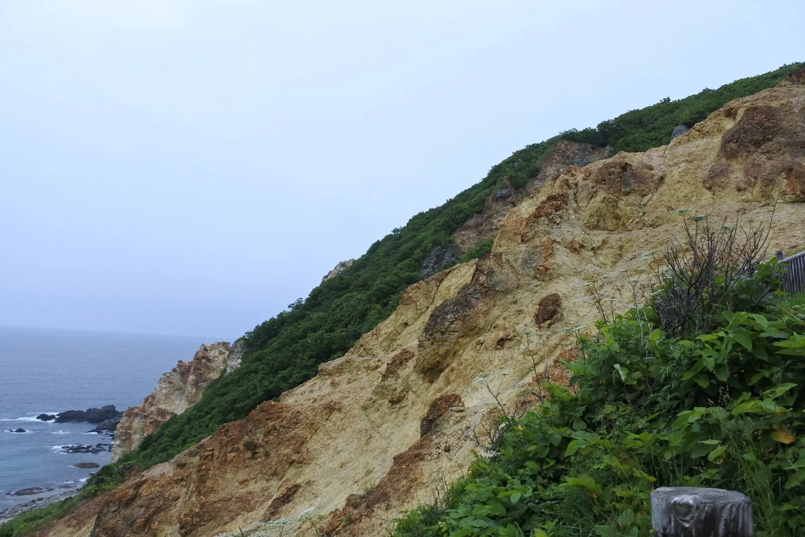
Part of the cliff face had turned yellow.
Below it, a deep blue sea.
Dark rock, a yellow patch, and the color of deep water.
Three colors, all at once.
What is that, we asked each other.
We landed on “probably minerals,” but we never confirmed it.
Here we hit one piece of bad news.
Shimamui Beach, at the far end of the tunnel, was closed to us that day.
The path down had collapsed, and access was restricted.
We had to settle for looking down on it from above.
So instead we walked the trail along the top of the cape.
The trail map marked one section as “the toughest part,” and we walked as far as that.
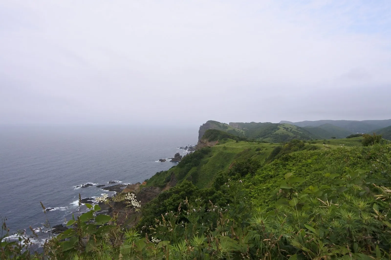
A green plateau simply drops straight into the sea.
The trail was narrow, with grass crowding in from both sides.
It was, admittedly, a trail where you couldn’t see far ahead.
What made it worth walking was the stretch just past the lighthouse.
Black rock, the yellowed patch, deep sea, and green leaves.
That was the spot where the combination looked its best.
One more thing that stuck with me: a section like a tunnel of trees.
The whole trail was hemmed in by grass, but for a short stretch the trees closed over our heads.
You step suddenly into shade, and the air changes.
It was brief, but it stayed with me.
To be honest, though: interesting, yes, but not on Cape Kamui’s level.
Which is exactly why doing Cape Kamui first was the right move.
For the timing, and for the weather.
If we’d done them in the other order, we might have missed the one thing we most wanted to see.
| Location | Shakotan-cho, Shakotan District, Hokkaido |
| Parking | Yes |
| Highlight | The view at the far end of the pitch-black tunnel, the yellow-stained cliff, and the trail beyond the lighthouse |
| Note | The path down to Shimamui Beach may be closed depending on conditions |
Cape Ogon — a forest walk, and a sea otter
Next we headed for Cape Ogon (Ogon Misaki).
This one felt more like walking through a forest than Cape Shakotan did.
There are ups and downs, but the trail is wider.
With no grass to push through, it was an easy, relaxed walk.
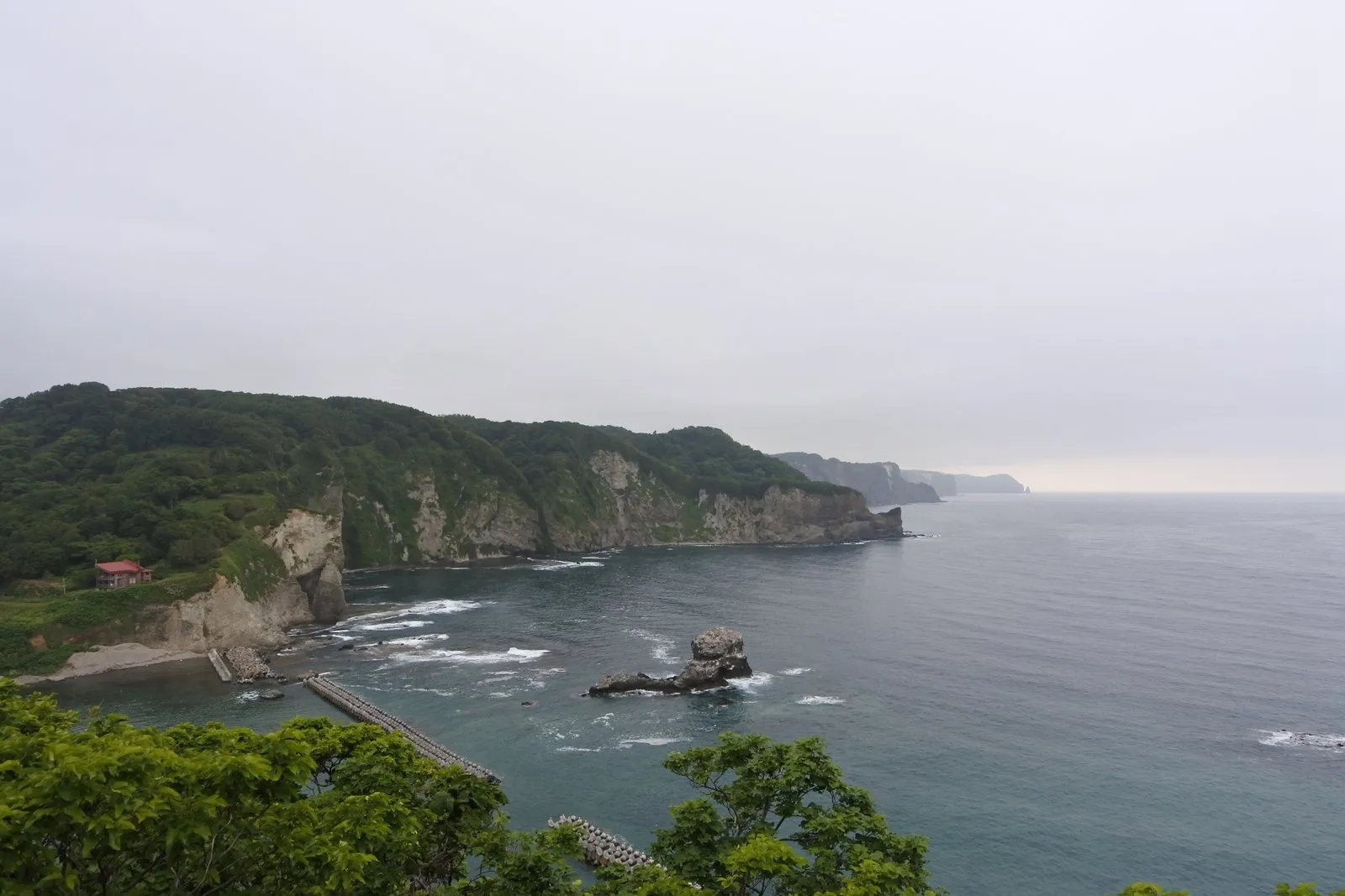
At the high point, a small harbor appeared below us.
A cove ringed all the way round by cliffs.
And out in the water, a rock.
My wife took one look at it and said:
Once she’d said it, it was unmistakably a sea otter.
Floating on its back, the way they do.
It doesn’t seem to have an official name, so in our house it’s been Sea Otter Rock ever since.
I suspect this cape would be even better at sunset.
That thought kept surfacing as we walked.
Still, the verdict for the day didn’t change.
Cape Kamui, in a class of its own.
Nothing else got close.
| Location | Bikuni, Shakotan-cho, Shakotan District, Hokkaido |
| Parking | Use the Shakotan Town Hall parking lot |
| Highlight | The forest trail, and the view down onto the cove and harbor from the high ground |
| Watch out for | Some ups and downs. The trail is fairly wide |
Candle Rock — one thin pillar in a grey sea
Driving on, we spotted a thin column standing out in the sea.
Rosoku Iwa — Candle Rock.
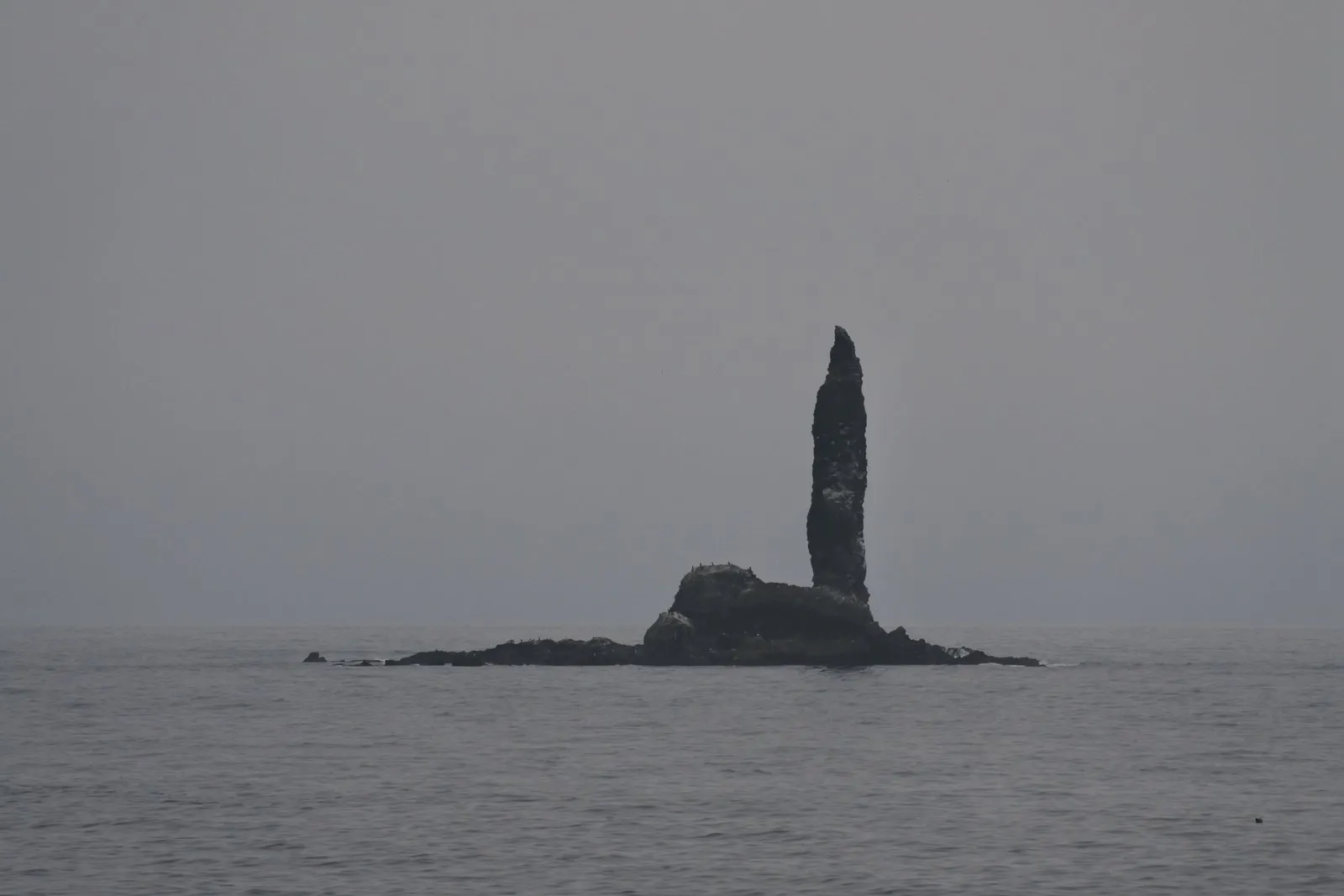
It was thinner than any of the rocks we’d seen so far.
A single pillar, rising from a flat reef.
The sky and the sea were both grey that day.
It stood in the middle of it all like a silhouette.
When the setting sun lines up behind it, we were told, it looks like a lit candle.
At that hour, I imagine it would leave a very different impression.
The Ebisu and Daikoku Rocks — which one is which?
Our last stop of the day was the pair known as Ebisu Iwa and Daikoku Iwa.
Two rocks stand side by side in the sea.
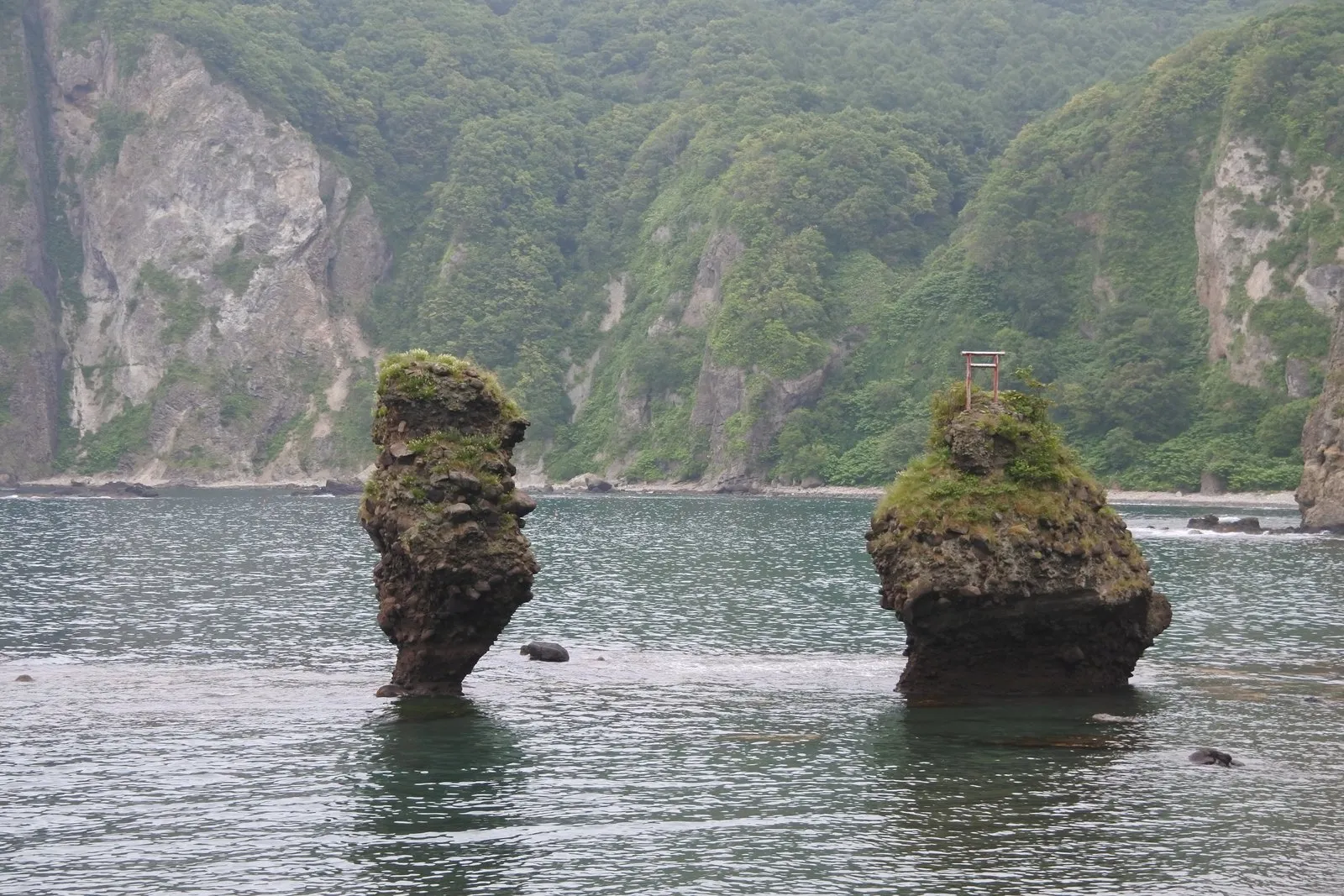
The one on the left is thin, and flares outward at the top.
The one on the right is stout, with a tiny red torii gate perched on its summit.
They’re named after Ebisu and Daikoku, two of Japan’s Seven Lucky Gods — the pair associated with good fortune in business.
We stood there comparing them for a while.
We never did settle it.
What bothered me more was the thin one.
I couldn’t understand how it stays upright at that width.
The base has been eaten away, and the top overhangs.
I genuinely thought it might topple over any day now.
There was an explanatory sign beside the road.
Because they stand at almost the same height, the sign added, they are sometimes also called meoto-iwa — "the married-couple rocks."
As for their origin, the sign described them as bodies of volcanic conglomerate containing andesite pebbles, washed out by the waves, and originating from rock formed when lava erupted underwater and was rapidly cooled.
Rock that solidified suddenly in the sea, then spent a very long time being washed by waves, until only these two were left standing.
Seen in that light, even the thin one that looked ready to fall starts to seem like a remarkable survivor.
The sign also noted that from the west side, with Cape Eboshi in the background, the view is particularly beautiful.
And the rock behind us, when we turned around, was interesting in its own right.
White mixed with brown.
And the white wasn’t a single white, either.
Dense white and pale white alternated in bands.
The two rocks in the sea are the main event, but there was something to look at on the landward side as well.
| Location | Shakotan-cho, Shakotan District, Hokkaido |
| Parking | Roadside parking space along the coast |
| Highlight | The two rocks standing side by side. An on-site sign explains how they formed |
| Note | Visible from the roadside. The banded rock face on the landward side is worth a look too |
Changing the plan was the right thing to do
In one day we walked three capes and looked at more rocks than I can count.
Of all of it, what stays sharpest is Cape Kamui.
The wind that made it hard to breathe.
The view that changed with every step, and changed again when I turned around.
The white, yellow, and purple flowers along the trail.
And the sea, split into two blues.
It’s a place I’d go back to for that alone.
Cape Shakotan and Cape Ogon were both worth the visit, no question.
But if you ask which one I’d return to, the answer is Cape Kamui.
Candle Rock and the Ebisu and Daikoku rocks were detours of a few minutes each, a quick stop and back in the car.
Even so, the time we spent arguing about how that thin rock stays standing is firmly lodged in my memory.
And above all, there’s that decision: looking at the day-two forecast and flipping the whole plan.
If we’d stuck to the schedule, we’d never have walked Cape Kamui under that wind and that light.
Ten years after a friend first told us to go, we drew the best possible day.
That’s the kind of trip it turned out to be.
Geological references: on-site interpretive sign (Ebisu Iwa & Daikoku Iwa). Statements written as "is said to" or "is thought to" reflect prevailing interpretation and estimation rather than settled fact.