📅 Visited: October 2022
We came out from between the trees, and my feet stopped.
There was a lake in front of us.
And on its surface, a whole mountain range.
The forest in autumn color, and the peaks lined up above it, were both sitting there in the water, flipped upside down and perfectly intact.
There was no wind, so the boundary was almost impossible to find.
I stood looking for a while, and still couldn’t tell where the real landscape ended and the reflection began.
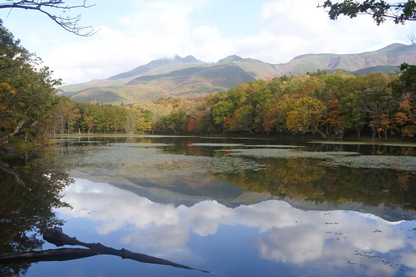

This is Shiretoko Goko — the Five Lakes of Shiretoko.
They sit on the Shiretoko Peninsula, a long finger of land jutting into the Sea of Okhotsk at the far eastern edge of Hokkaido.
And on this particular day, we walked that whole trail clapping our hands.
Walking through brown bear country, clapping as we go
We visited the Five Lakes on October 14.
Originally we’d planned to go on the afternoon of the 15th.
But the forecast for that afternoon showed a high chance of rain, so we moved it forward a day.
Then, over lunch, something stopped me mid-bite.
I was scrolling through social media and saw that a brown bear had been spotted swimming in the third lake that morning, and the ground trail had been closed.
We might get there and not be allowed in.
We decided to drive over anyway and take our chances.
We arrived around 1:10 p.m.
The trail was reopening at exactly that moment.
We slipped into the 1:20 p.m. briefing with seconds to spare.
The briefing covered nature conservation in Shiretoko and, of course, brown bears.
What I remember most is the part about how to walk.
Call out loudly — “hooey, hoy!”
Clap your hands, sharp and steady, as you go.
The point is to let a bear know you’re there early enough that it can move away from you.
It’s a sound for avoiding an encounter, not a sound for driving an animal off.
Hearing that before we set out changed the meaning of the clapping completely.
And in practice, I clapped almost continuously the entire way.
There was one other thing I hadn’t expected.
The trail itself.
I’d assumed it would be more developed than it was.
In reality, much of it is barely a path at all.
There are only short stretches of boardwalk; the rest is mud, roots, and a fair amount of up and down.
Walking it, one thought kept surfacing.
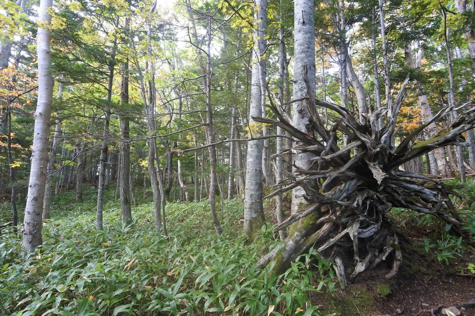
That thing in the right foreground of the photo is the root plate of a big tree that came down roots and all.
The roots are still fanned out in a circle, standing up out of the ground.
The fallen trees here, we were told, point almost uniformly north.
Because the wind that knocks them over comes from the south.
Once someone says that and you look around, the toppled trunks really do line up.
The direction of the wind, recorded inside the forest.
It hadn’t occurred to me that you could read a forest that way.
From the fifth lake to the first, the forest keeps changing
The ground trail loops from the fifth lake around to the first.
What I found most interesting was how clearly the character of the trees changed between the first half and the second.
Early on, pale trunks like birch stand out.
The ground is wetland, thick with moss.
Later, the trees shift to more ordinary-looking ones.
Bamboo grass and other undergrowth appear, mixed with yellow autumn color.
You’re walking one continuous course, and yet somewhere along the way you seem to step into a different forest.
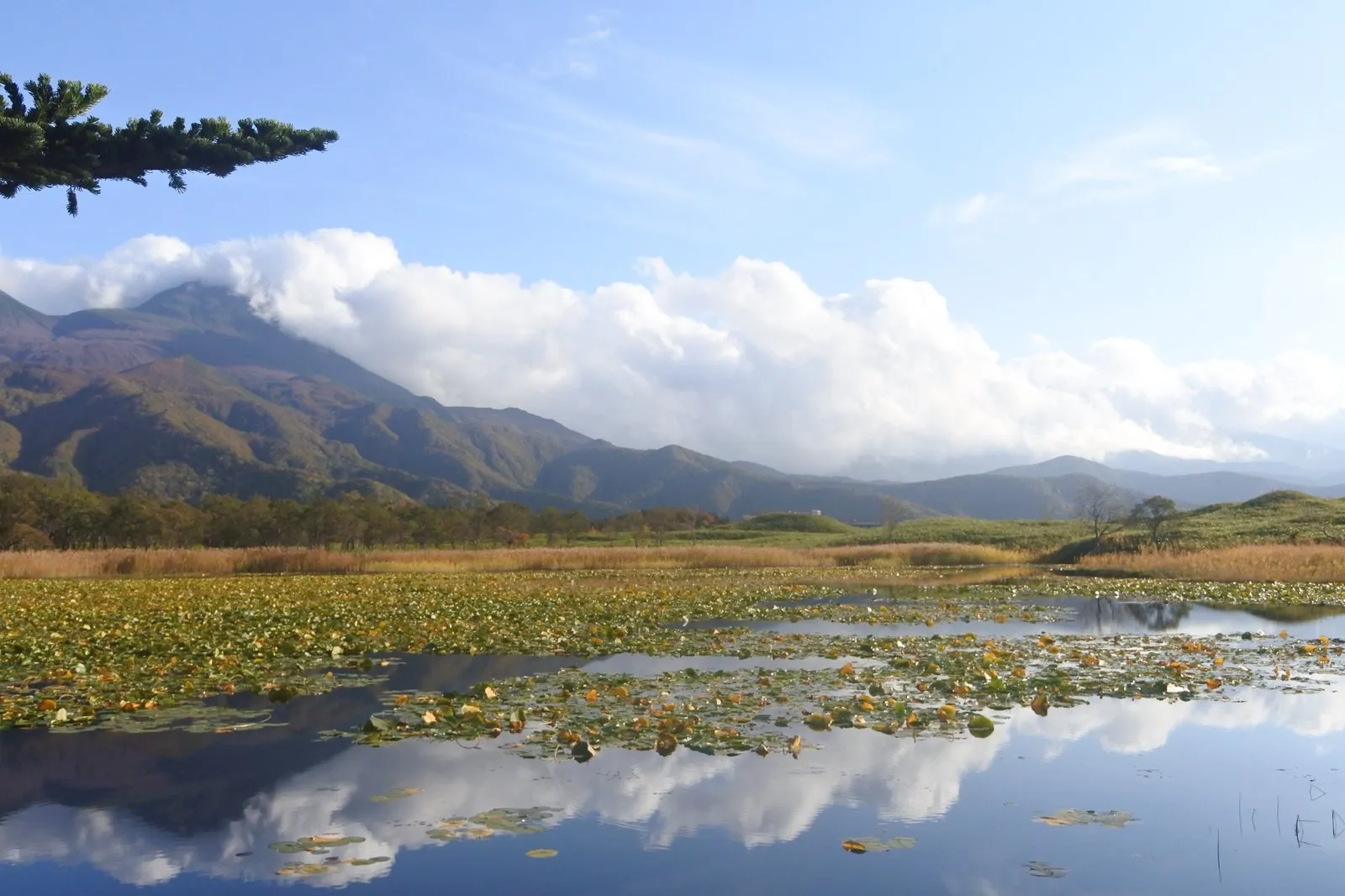
The lakes each had their own face, too.
One was carpeted edge to edge in water lily pads; another held nothing but quiet aquatic plants.
Beyond them, a range of peaks wearing cloud.
Which raises the question: why are there several lakes lined up like this in the first place?
And the bumpy, uneven ground around the Five Lakes is thought to be terrain left behind by events such as volcanic edifice collapse, with water later pooling in the hollows.
In other words, these lakes weren't dug into flat land. The low spots in ground that was already uneven simply became lakes.
Walk the trail with that in mind and the climbs and descents between the lakes start to mean something. Each rise you cross is one of the high points of that collapsed terrain.
That made sense of things.
Even the ups and downs on that barely-there path had a reason behind them.
We never did meet any animals.
I’d assumed we’d at least see squirrels or birds — though perhaps that’s what happens when you walk making noise the whole way.
What we did see were holes. Lots of them, bored into the trunks.
Woodpeckers, presumably.
It was a forest where nothing showed itself, but the traces of everything were everywhere.
The elevated boardwalk, and a sign that says “World Natural Heritage”
At the end of the ground trail, you join the elevated boardwalk.
And the landscape changes in an instant.
The boardwalk runs straight off into the distance.
Nothing blocks the view, and beyond it the Shiretoko mountain range lies stretched across the horizon.
Moments earlier we’d been pushing through bamboo grass.
The sense of openness made it hard to believe it was the same place.
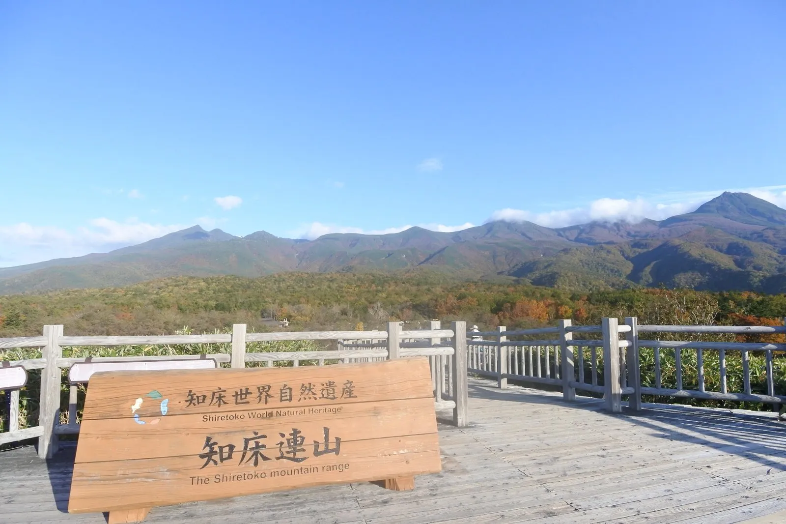
There was a wooden sign standing on the boardwalk.
“Shiretoko World Natural Heritage.” “The Shiretoko mountain range.”
Which reminded me: this is a World Natural Heritage site.
While we were walking, my head had been so full of bears and footing that I’d forgotten entirely.
The nutrients the ice brings are said to feed phytoplankton, which in turn support the creatures of the sea.
And the sea's bounty crosses onto the land through salmon. The nutrients of the ocean reach the brown bears and eagles that eat them.
It was this link between sea and land that earned the recognition, and Shiretoko was inscribed as a World Natural Heritage site in 2005.
The forest we'd been walking through, clapping as we went, and the sea we could see in front of us. Two things I'd taken for separate turn out to be one continuous system.
And then the day delivered its closing scene.
We’d bought a tote bag with a brown bear printed on it from the shop, and were driving back.
The car ahead of us had stopped in the middle of the road.
An accident, I assumed.
It wasn’t.
It was a brown bear.
It crossed the road slowly, left to right.
From inside the car, we simply watched it pass.
A whole day of clapping to avoid meeting one — and then we met one, from a car.
It struck me as so funny that I laughed for a good while.
| Location | Shari-cho, Hokkaido (the Utoro side of the Shiretoko Peninsula) |
| Parking | Lot at the Field House |
| Highlight | Mountains mirrored on the lakes, the old-growth ground trail, and the elevated boardwalk facing the range |
| Watch out for | The ground trail requires attending a briefing, and closes when brown bears are around. Expect mud and elevation change — wear walkable shoes |
The Aurora sightseeing boat — looking up at black cliffs from the water
The next day we went out to sea.
We took the Shiretoko sightseeing boat, the Aurora.
It’s a round trip of a little over an hour, tracing the peninsula’s coastline from the water.
The first thing that surprised me was the sound.
The seabirds are astonishing.
They wheel around the boat, calling without pause.
And then, the rock.
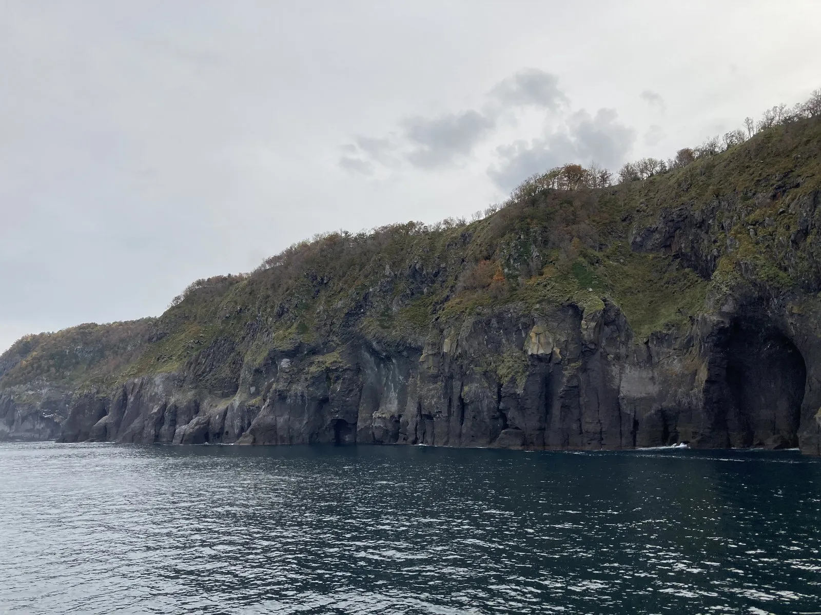
It is simply enormous.
A black wall of rock drops straight into the water.
Its surface is split vertically, as if a bundle of fine columns had been stood on end.
Lower down, caves open like mouths in the stone.
Ground away, hard, by heavy seas and drift ice.
That’s the feeling that comes off it as you look.
What I found interesting was that the geology seemed to change from place to place.
One wall would look obviously hard, fracturing into sharp edges.
The next would look softer, slumped into a crumbling slope.
The same coastline runs on continuously, and yet the way it has been worn away is completely different.
And the column-like pattern in the rock is said to be columnar jointing, which forms as lava cools and contracts.
Lava and volcanic debris differ in hardness and in how tightly they're packed. So even within a single cliff, the hard parts survive as sharp edges while the weaker parts are worn away first.
That, it's thought, is why the face of the coast looks so different from one stretch to the next. What we were looking at from the boat seems to be a cross-section: what the volcanoes piled up, re-carved by the waves.
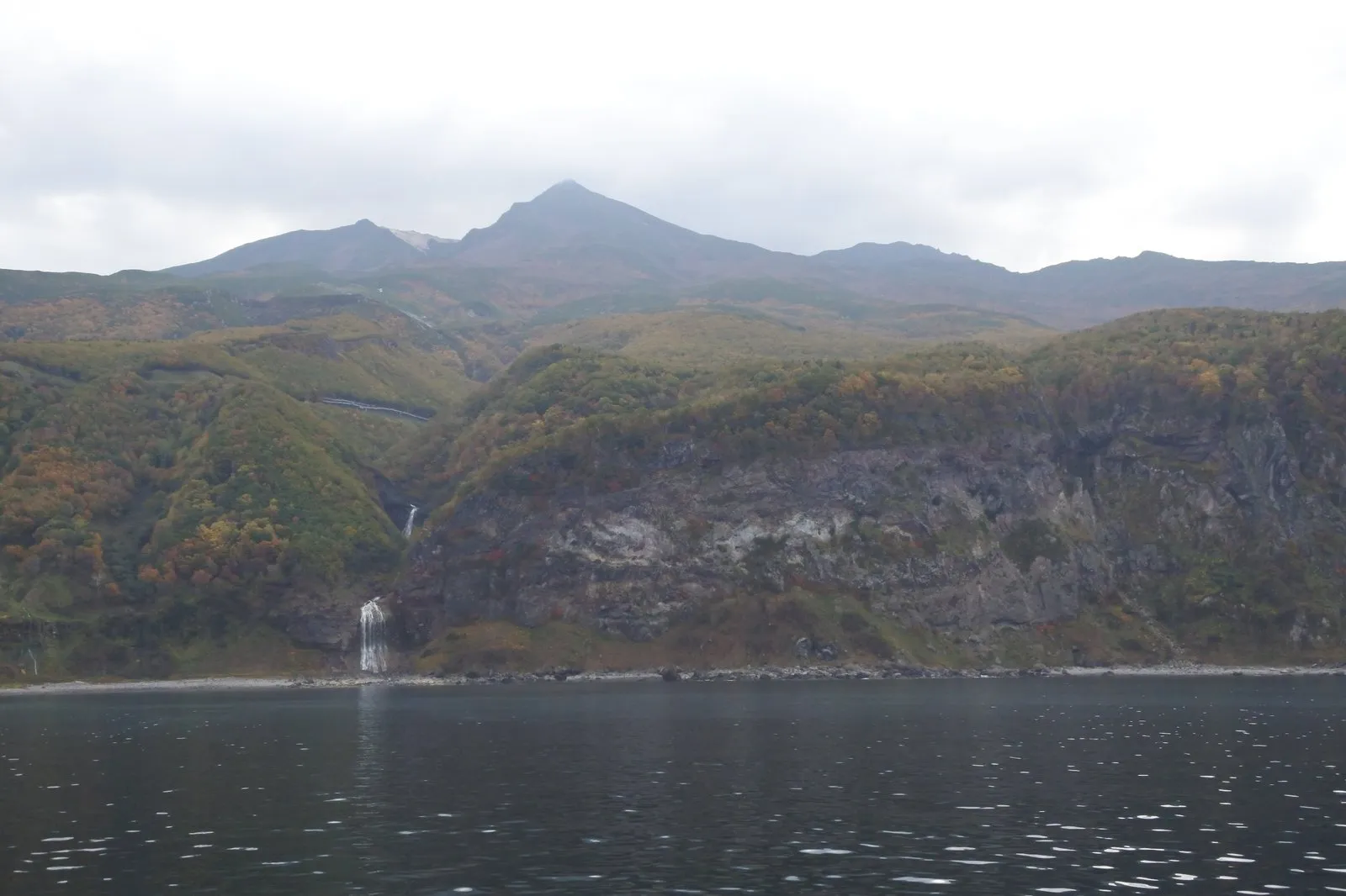
In one place a slender waterfall dropped straight into the sea through a cleft in the cliff.
Behind it stood a mountain wearing a cap of cloud.
Mountain, cliff, waterfall, and sea, all inside a single frame.
That was the kind of view it was.
On the way out, everyone was up on deck.
On the way back, more and more people drifted inside.
Partly the wind was cold — but I think, mostly, people had had their fill.
We had too.
There are smaller boats that push further up the coast, but by then we felt that this was enough for one trip.
Back at the harbor, we went to see Oronko Rock and Godzilla Rock.
Oronko Rock is, above all, big.
As for Godzilla Rock, my first honest reaction was this.
Then we walked a little further, the angle shifted — and there he was, properly Godzilla.
That a rock can turn into a creature purely by where you stand is a fine thing.
| Location | Utoro, Shari-cho, Hokkaido (Utoro Port) |
| Duration | We took the round-trip route of a little over an hour |
| Highlight | Sea cliffs and columnar rock seen from below, thin waterfalls dropping off the cliffs, and the seabirds |
| Watch out for | The deck is cold — bring a jacket. Oronko Rock and Godzilla Rock are near the port |
Furepe Falls — twenty minutes, three completely different landscapes
Here’s the place I’d call the best-kept secret of the whole trip.
Furepe Falls.
It’s about twenty minutes on foot from the Shiretoko Nature Center, one way.
There was almost nobody there.
And more than anything, the scenery keeps transforming as you walk.
You start out among trees.
Then the trees give way and you come out onto open grassland.
And then that grassland stops, abruptly.
A cliff.
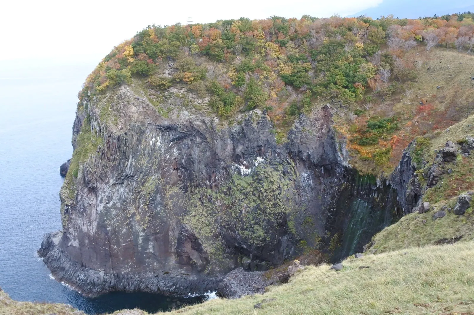
The grass simply ends, and below it is the sea.
And on the rock face opposite, water runs down a hollow in dozens of separate threads.
It isn’t one thick waterfall.
It’s more as though the entire wall were wet with fine strands of water.
Forest, grassland, cliff and falls.
In twenty minutes we’d passed through three different landscapes.
I’ll be honest — that’s exactly what I said.
It doesn’t have the fame of the Five Lakes.
But purely as scenery, it was wonderful.
I’d like to come back here.
In a different season, or in the same one; either would be fine by me.
| Location | Shari-cho, Hokkaido (between Utoro and the Five Lakes) |
| Parking | Lot at the Shiretoko Nature Center |
| Access | About 20 minutes each way on the trail from the center, from woodland to grassland to clifftop |
| Watch out for | Stay behind the fence at the cliff edge. This is brown bear habitat — don't walk it alone |
Oshinkoshin Falls — “Oh, that’s GOOD!”
Later the same day we drove to another waterfall.
Oshinkoshin Falls.
We got out of the car, climbed the steps, and the words came out of me on their own.
“Oh, that’s GOOD!”
The force of it is remarkable.
A broad sheet of water comes down a rock slope, breaking white the whole way.
Step closer and even the air is different.
It’s cool.
A fine spray hangs in it, landing chill on your skin.
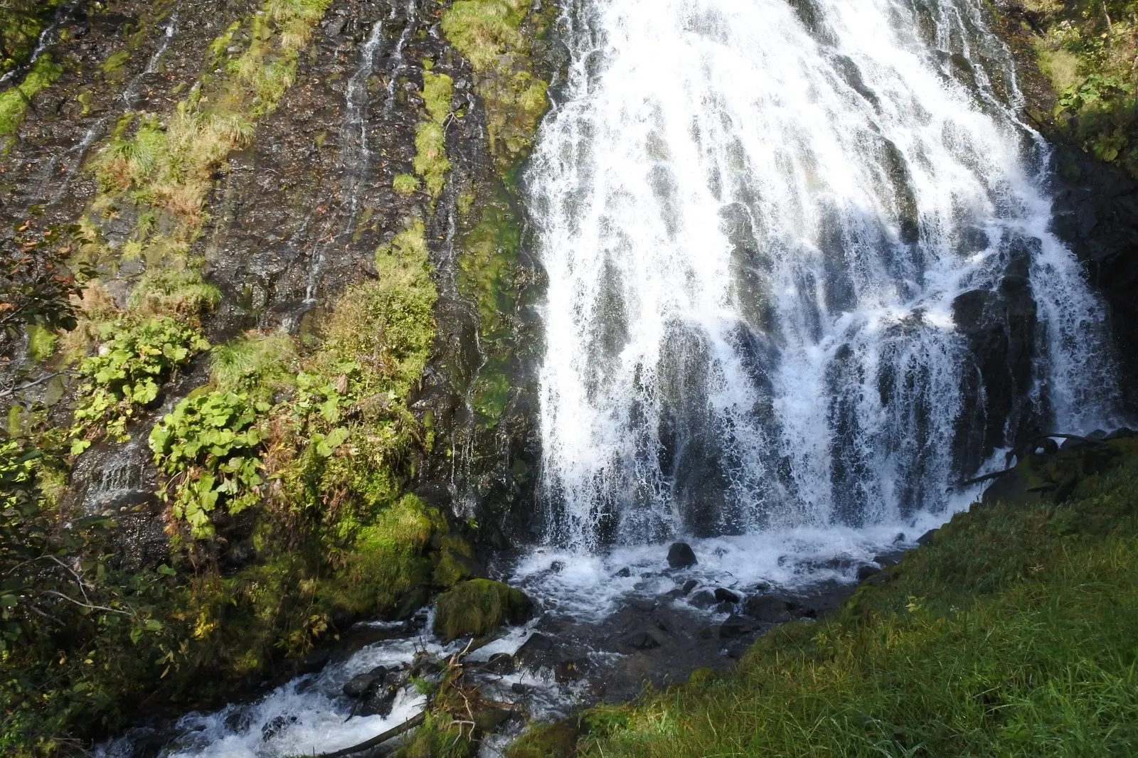
Higher up, the water had turned to mist.
By then it isn’t really a flow at all — it looks like white smoke.
This would be lovely and cool in summer, I thought.
I’d actually been here once before, ten years earlier.
The weather that day was far better than it had been then.
I was struck by how much a waterfall can change simply because the sky has changed.
It really is good.
Of all the waterfalls we saw in Shiretoko, this one was the most overwhelming.
| Location | Shari-cho, Hokkaido (just before Utoro) |
| Parking | Lot right in front of the falls |
| Access | Up a flight of steps from the lot and you're there; you can get close to the base of the falls |
| Watch out for | The steps and rock are wet with spray and slippery |
We stopped at two more places that day.
One was Sandan Falls, the “three-tier falls.”
We learned that it’s fed by the Oshokomanai River.
There was nobody here either.
Coming down in three separate steps, it has real presence.
A genuinely hidden spot.
The other was Onnebetsu Bridge.
At the foot of the bridge there’s an outcrop where old strata are exposed.
That was a striking sight in itself.
And there were salmon in the river.
I mentioned earlier that the sea’s nutrients are said to travel onto the land through salmon.
Here were those salmon, in the river right in front of me.
The story and the landscape connected on the spot.
The luxury of doing nothing
Rain was forecast for the afternoon.
So we cut the day short and checked into the hotel around two.
That turned out to be unexpectedly good.
We sat and stared out of a big window at nothing in particular.
And the light went out of the day while we did.
On past trips I’d always crammed the schedule, muttering about what a waste it would be otherwise.
I’d try to get to as many places as possible in a single day.
But sitting there, I realized that time spent doing nothing is also part of a trip.
Everything in Shiretoko is on a vast scale.
Watching that vastness from a hotel window, with nothing to do.
That, in its own way, was a luxury.
Shiretoko Pass and Mt. Rausu — crossing the spine of the volcanoes
On the third day we crossed the peninsula.
Route 334, from the Utoro side over to Rausu.
The sky was clear again.
As you drive, a mountain appears dead ahead.
Mt. Rausu.
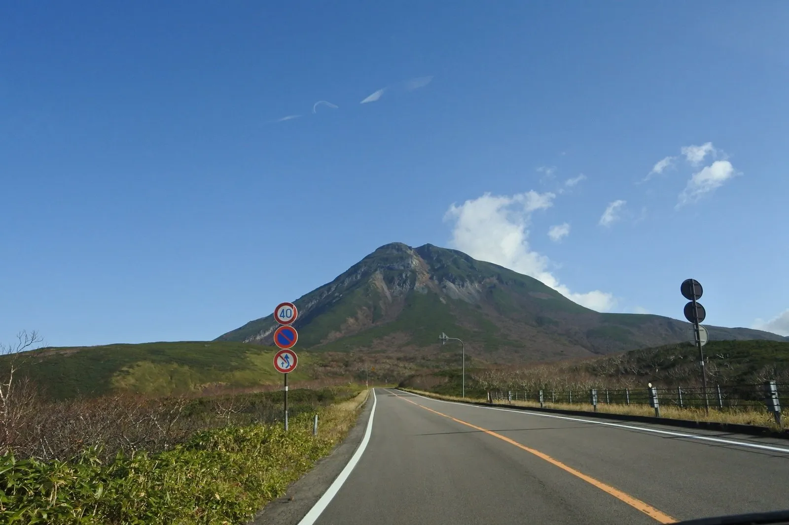
A mountain standing squarely at the end of the road.
That was the shape of the drive.
Mt. Rausu was clearly visible from the lookout at Shiretoko Pass, too.
The cliffs we’d looked up at from the boat the day before.
The lava and volcanic debris that built those cliffs are said to have flowed out of mountains like this one.
And now here I was, crossing that mountain’s foot.
Thinking of it that way changed the meaning of the pass a little.
Less like driving to the other side of a peninsula, more like stepping over the spine of a volcano.
| Location | On the boundary of Shari-cho and Rausu-cho, Hokkaido (National Route 334) |
| Parking | Lot at the lookout on the pass |
| Highlight | The view of Mt. Rausu, on the pass road linking the Utoro and Rausu sides |
| Watch out for | Closed in winter, and the weather changes quickly |
The Rausu geyser, and a second brown bear
Over the pass, we dropped down to the Rausu side.
We were headed for the Shiretoko Rausu Visitor Center.
And there, it happened again.
A brown bear.
It came down along the river and walked straight across the road.
Two days later, and bear number two.
When we reported it at the center, they gave us a sticker.
They collect sighting reports, it turns out.
Saying “I saw one” is genuinely useful in this place.
Learning that visitors’ sightings accumulate into a record made me quietly happy.
Behind that visitor center there’s one more thing worth seeing.
A geyser.
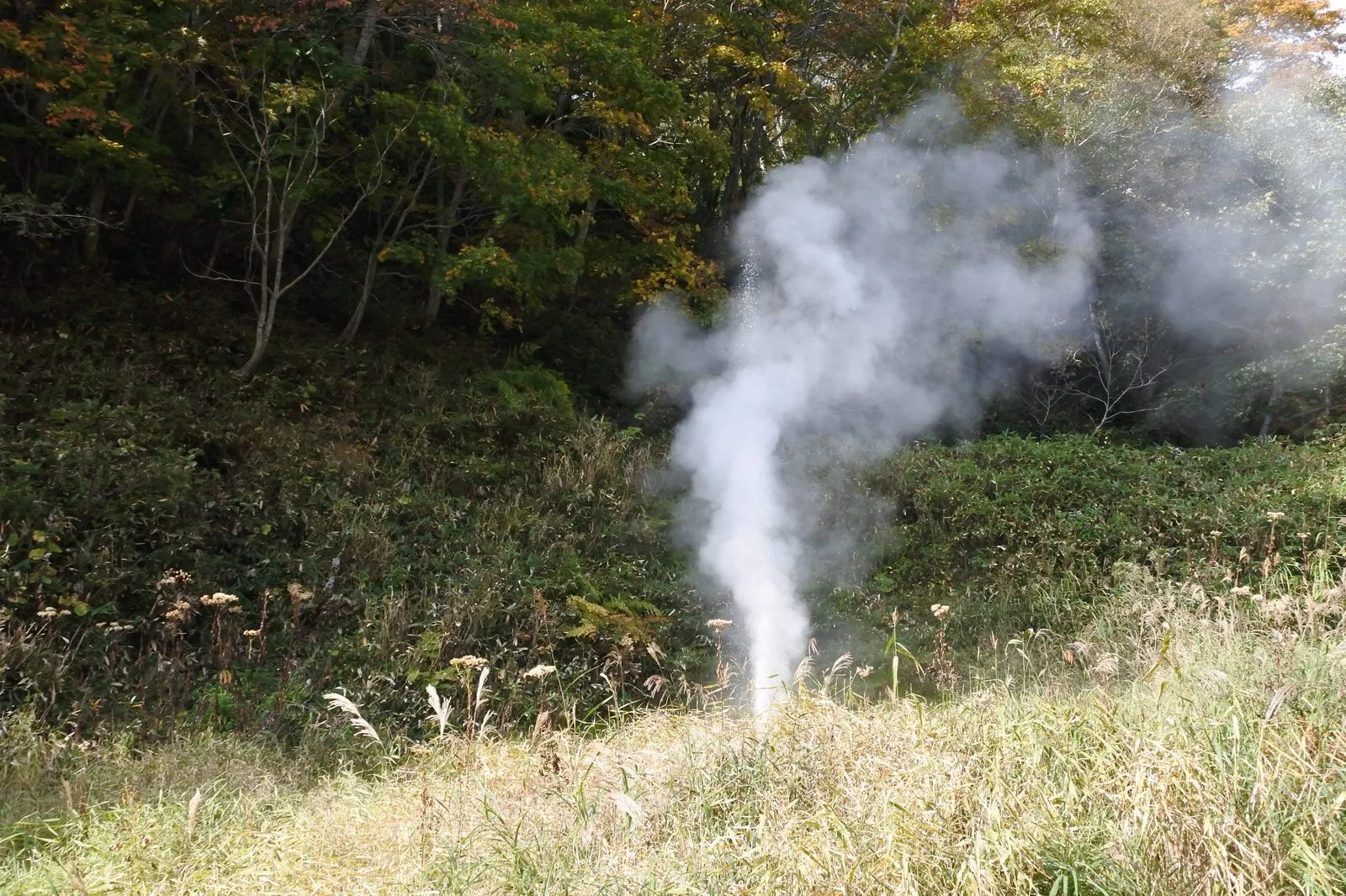
White steam was rising in a column out of a slope of bamboo grass and autumn leaves.
Everything around it is perfectly ordinary forest.
And one single point on that ordinary slope is breathing out steam.
The mismatch is exactly what made it stick with me.
And this is thought to show that Shiretoko still holds volcanic heat today.
The black cliffs we looked up at from the boat, and Mt. Rausu seen from the pass, are both the results of volcanic activity long ago.
But this steam isn't a story about the past. Evidence that the ground below is still hot was erupting right in front of us.
Afterwards we also stopped at the Rausu Kunashiri Observation Tower.
And then the car turned south.
To the Notsuke Peninsula — white dead trees and a narrow road of sand
Driving down the coast from Rausu, the landscape began to change.
The trees thin out.
And they turn white.
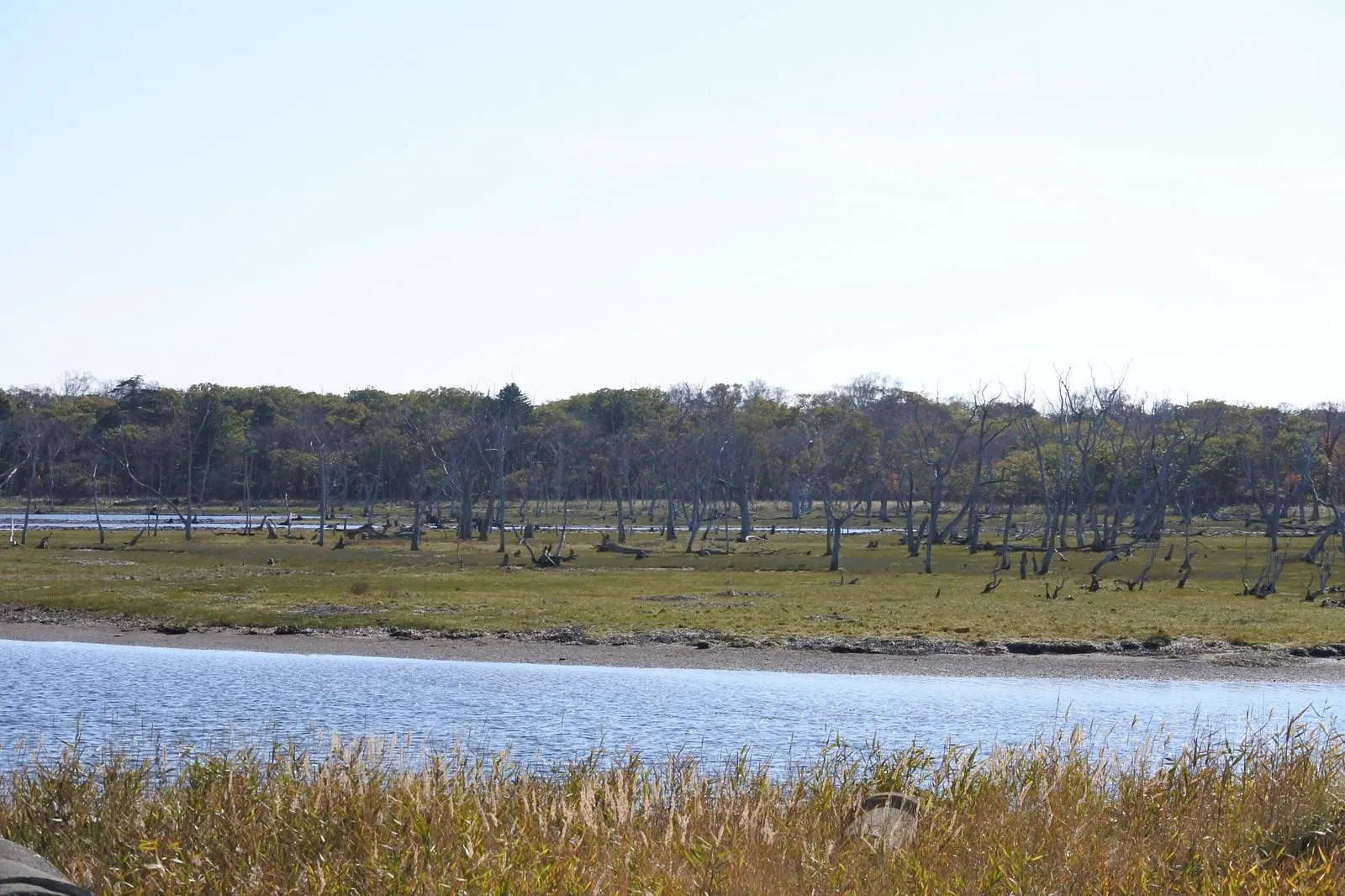
This is Narawara.
Beyond a shallow sheet of water stood a stand of white, dead trees.
There are no leaves.
Only trunks, standing straight up.
Here and there, a few leaned where the wind had pushed them.
It isn’t a living forest, and it isn’t a clear-cut.
It’s a place where trees died on their feet and were left exactly as they stood.
Which means it is, from the outset, low land made of nothing but piled sand, barely above sea level.
Add subsidence of the ground and the effects of seawater, and the trees are thought to have died where they stood.
The tracts of standing dead trees left behind are called Narawara and Todowara.
They're still standing rather than fallen, and you could say that's because you're seeing two spans of time at once: the time when this was forest, and the time since the sea came in.
We spent about two hours at the Notsuke Peninsula Nature Center, all told.
From there you walk out to Todowara.
This is the thought that came out of me on the way.
An honest note, too.
Going as far as the end of the boardwalk might have been enough.
Past that point the footing is poor, and while the scenery was good, it didn’t quite reach the level of moving.
And the most interesting thing about the Notsuke Peninsula is, in fact, its shape.
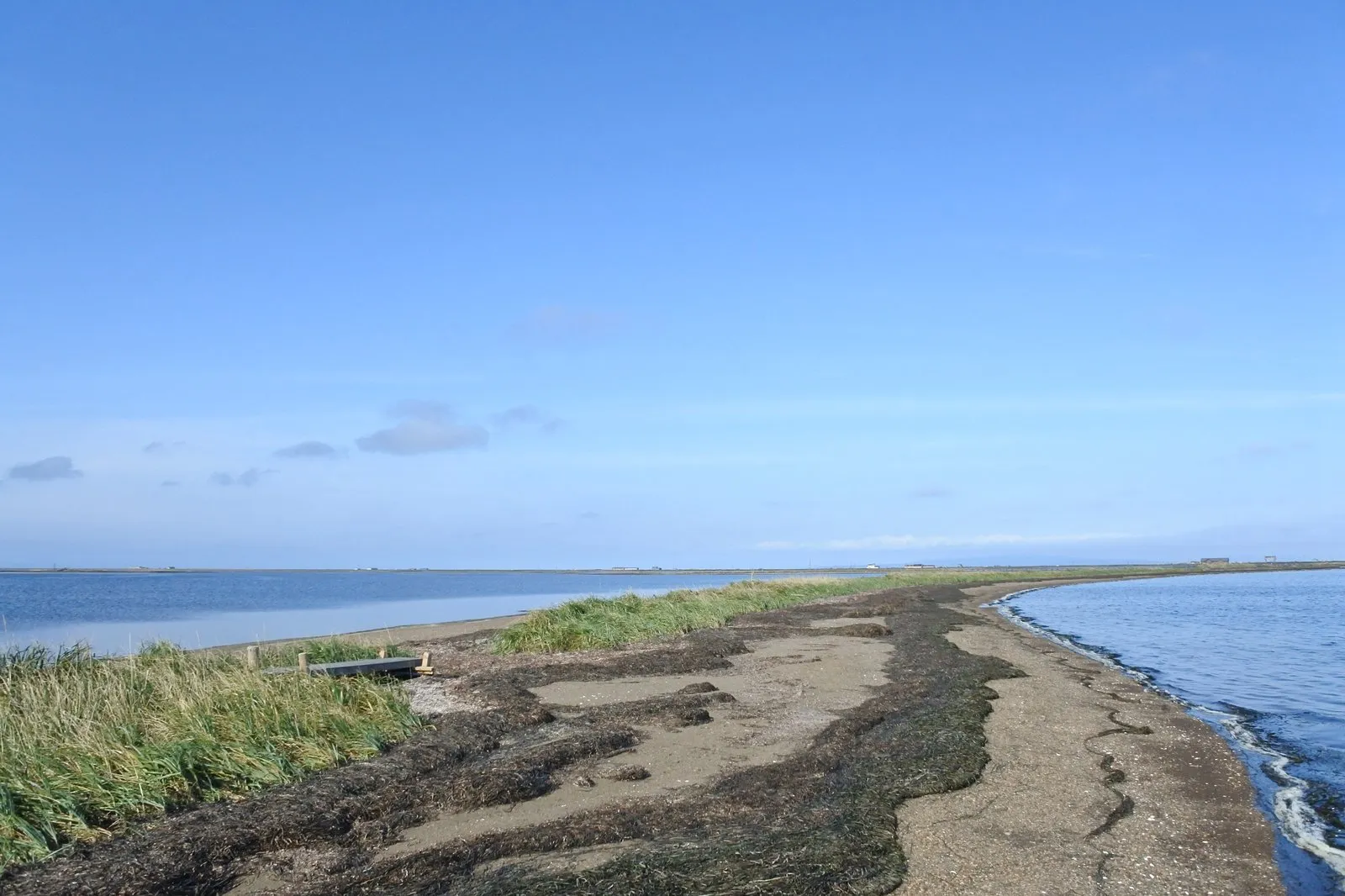
A thin ribbon of sand, with sea on both sides.
The open ocean on one, the inner bay on the other.
And you’re walking along the slight rise in between.
Seaweed thrown up by the waves lay along the beach in long stripes.
How narrow it really is, though, is hard to take in from ground level.
This place must be most interesting seen from a satellite image.
That’s the conversation we ended up having as we walked.
It may be a rude thing to say about a landscape.
But the shape of this peninsula is unusual enough that I genuinely mean it.
We also met Ezo sika deer that day.
Once from the car on the way to the Nature Center.
And again on the walk back.
The deer on the return leg was very close.
It looked right at us and didn’t run.
Nothing at all like the distance we’d kept from the bears.
| Location | Betsukai-cho, Hokkaido (Notsuke Peninsula) |
| Parking | Lot at the Nature Center |
| Access | Walk out to Todowara from the center; Narawara is visible from the peninsula road |
| Watch out for | Footing is poor past the end of the boardwalk. There's no shelter and the wind is strong. You may meet Ezo sika deer |
| Location | Rausu-cho, Hokkaido (down on the Rausu side from Shiretoko Pass) |
| Parking | Lot at the center |
| Highlight | The geyser at the end of the trail out back, sending up a column of white steam |
| Note | You can report brown bear sightings here. The surrounding area is bear habitat |
What stayed with me was the sheer scale
Three days in Shiretoko.
Looking back, what remains isn’t the individual famous places.
It’s the size of everything.
Water wide enough to hold an entire mountain range on its surface.
The peaks stretched across the whole field of view at the end of the elevated boardwalk.
The black cliffs running on and on, seen from the boat.
And a narrow road of sand with sea on either side.
Not one of them would fit inside a photograph.
The Shiretoko Peninsula is said to have been formed by a chain of volcanoes standing in a line.
What those volcanoes piled up, the waves and the drift ice keep carving away.
Nutrients the sea carries reach the land through salmon, and the brown bears that follow the salmon come down the rivers.
The things we saw over those three days looked like scattered, separate landscapes — but I think they were all connected.
And it isn’t only the scenery that stayed with me.
The old-growth forest where I clapped for an entire day.
Oshinkoshin Falls, where “Oh, that’s GOOD!” came out of me unbidden.
The hotel afternoon spent watching the window go dark, doing nothing at all.
If I come back, I’d like to walk the Five Lakes in a different season.
With snow still lying, that water mirror must look like something else entirely.
And Furepe Falls I want to see again — different season, same season, it doesn’t matter.
That twenty-minute walk got under my skin that much.
Geological references: Geological Survey of Japan, AIST ("Geology Map Navi"); Geospatial Information Authority of Japan topographic maps. Statements written as "is said to" or "is thought to" reflect prevailing interpretation and estimation rather than settled fact.